File:Development map.png
Jump to navigation
Jump to search


Size of this preview: 800 × 552 pixels. Other resolutions: 320 × 221 pixels | 2,967 × 2,048 pixels.
Original file (2,967 × 2,048 pixels, file size: 278 KB, MIME type: image/png)
Society development levels
File history
Click on a date/time to view the file as it appeared at that time.
| Date/Time | Thumbnail | Dimensions | User | Comment | |
|---|---|---|---|---|---|
| current | 14:31, 12 March 2024 | | 2,967 × 2,048 (278 KB) | MustaphaTR2 (talk | contribs) | Small border change between MTO-AES. NTR law change. |
| 09:31, 6 November 2023 | 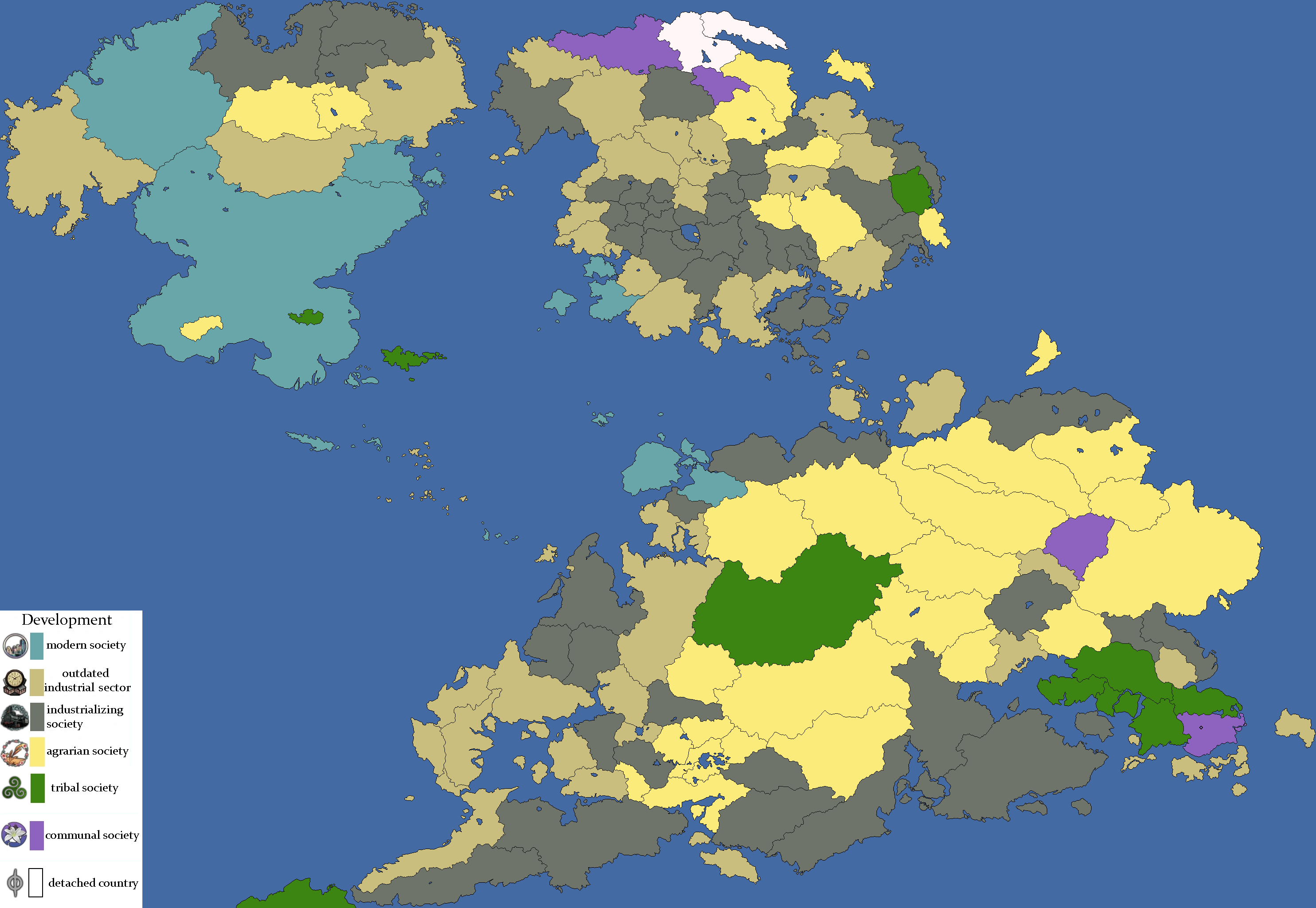 | 2,967 × 2,048 (278 KB) | MustaphaTR2 (talk | contribs) | ||
| 09:00, 12 June 2023 |  | 2,967 × 2,048 (278 KB) | MustaphaTR2 (talk | contribs) | Updated for 2.1. | |
| 10:04, 18 January 2023 |  | 2,967 × 2,048 (278 KB) | MustaphaTR2 (talk | contribs) | Some border/lake changes. | |
| 13:39, 12 December 2022 | 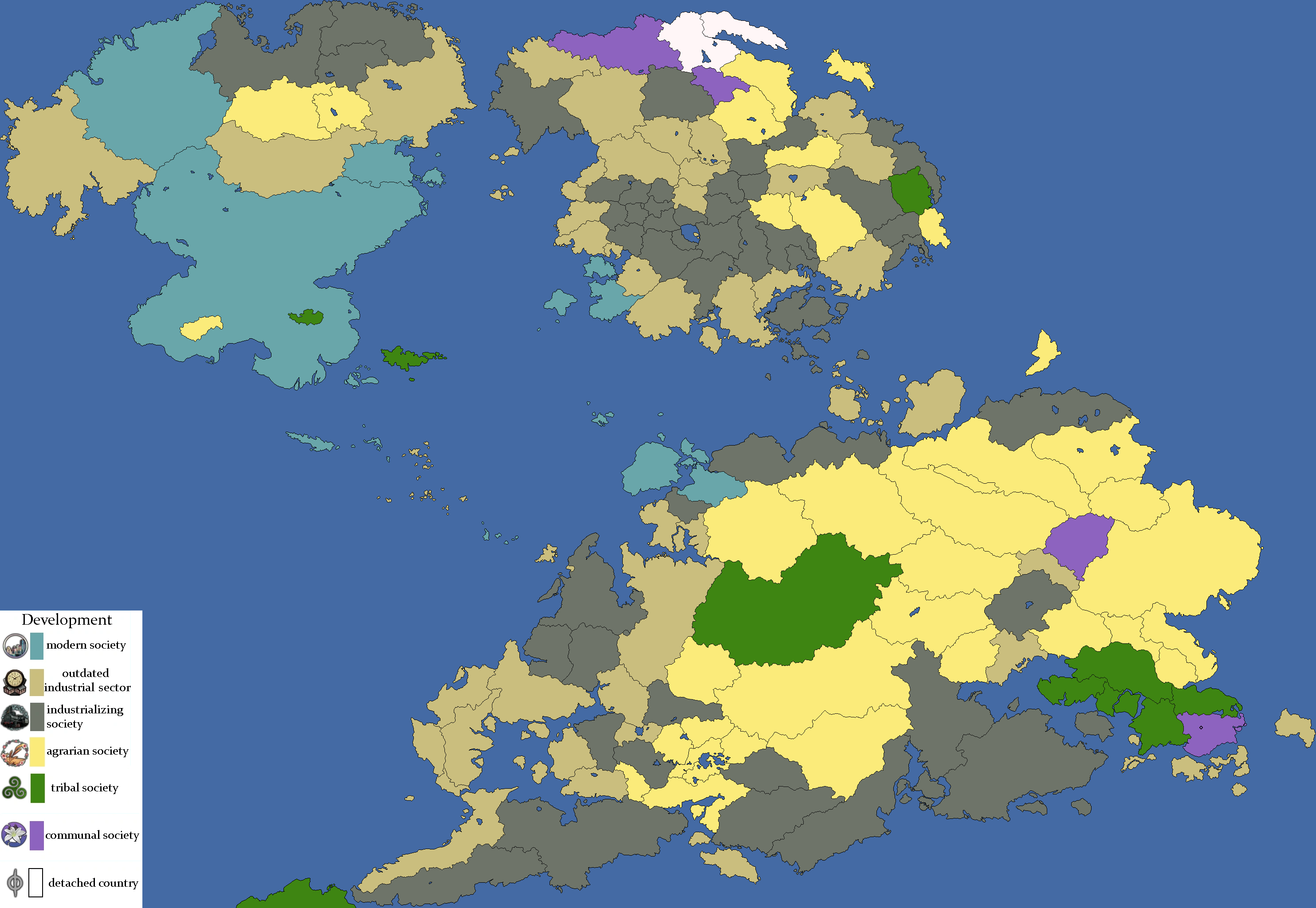 | 2,967 × 2,048 (278 KB) | MustaphaTR2 (talk | contribs) | ||
| 17:15, 4 February 2021 | 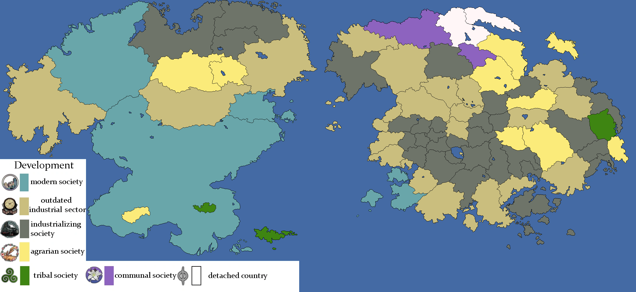 | 2,181 × 1,004 (180 KB) | MustaphaTR (talk | contribs) |
You cannot overwrite this file.
File usage
The following 3 pages use this file: